Belize is celebrated for its unparalleled concentration of ancient Maya sites in Central America, boasting over 1,400 documented locations that span an impressive timeline exceeding three millennia. From the awe-inspiring riverbank temples at Lamanai to the towering pyramids of Caracol, each archaeological complex offers invaluable insights into the intricate facets of Maya statecraft, religion, and the daily lives of the Maya people. This comprehensive guide will explore the nine essential ruins to visit, provide practical travel planning advice, and offer the cultural context necessary for an immersive encounter with Belize's archaeological marvels.
Uncover Why Belize Is the Heart of the Ancient Maya Civilisation
The rise of the Maya civilisation in what is now Belize can be traced back to at least 2000 BCE, flourishing robustly until well into the Spanish colonial era. The prosperity of this civilisation was significantly sustained by the fertile river valleys, particularly along the New River and Belize River, as well as coastal access to rich marine resources provided by the world’s second-largest barrier reef. Additionally, a sophisticated network of trade and political alliances bolstered their economic strength. Today, the Institute of Archaeology, which falls under the National Institute of Culture and History (NICH), oversees 14 official archaeological reserves, several of which are located within or adjacent to UNESCO World Heritage sites. Their continuous efforts, combined with years of academic research, shed light on how the Belizean Maya communities played a crucial role in shaping regional history.
Discover the 9 Must-Visit Maya Ruins in Belize for an Enriching Experience
Explore the Maritime Trading Centres of Northern Belize
Lamanai: The “Submerged Crocodile” – The Longest Inhabited Maya Site
Lamanai, originating from the Yucatec Maya term Lama’anayin, which translates to “submerged crocodile,” is strategically positioned along the banks of the New River Lagoon and boasts an impressive occupancy history stretching from the 16th century BCE to the mid-20th century CE. This site functioned as a pivotal trade hub, establishing essential connections between inland communities and coastal merchants. Visitors typically arrive by boat from Tower Hill, where they can discover the stunning Mask Temple, showcasing a remarkable 2.7-metre stucco mask representing the rain deity. Moreover, the Jaguar Temple and the High Temple rise majestically above the surrounding lush jungle canopy. Current archaeological excavations conducted by NICH have uncovered residential courtyards, a ball court, and substantial evidence of trade involving jade, obsidian, and ceramics (Institute of Archaeology, NICH).
Altun Ha: The “Rockstone Water” – Discover the Site of the Jade Head
Located approximately 50 kilometres north of Belize City, Altun Ha, which translates to “rock water,” gained international recognition in 1968 when excavators from the Royal Ontario Museum uncovered the spectacular 4.42 kg jade head of Kinich Ahau. This artefact is the largest carved jade object from the Maya civilisation and is now displayed at the Museum of Belize (Royal Ontario Museum). The site features the impressive 16-metre-tall Temple of the Masonry Altars, offering a commanding view over ancient trade routes that historically linked inland polities to Caribbean ports. Interestingly, unlike many other Classic-period centres, Altun Ha lacks inscribed stelae, indicating that its elite preferred monumental sculptures over hieroglyphic inscriptions (Pendergast 1979).
Santa Rita: A Site of Late-Period Cultural Contact and Exchange
Situated near Corozal Town, the Santa Rita site remained an active settlement well into the early colonial period. The artefacts unearthed here, including ceramics and Spanish-era objects, document the adaptations of the Maya to European influences and intercultural contact. Furthermore, the nearby Cerros site, interconnected by a network of causeways, underscores the economic resilience and evolving trade networks of northern Belize during the late period (Awe 2005).
Investigate the Political Epicentres of Western Belize (Cayo District)
Xunantunich: The “Stone Lady” Legend and Its Majestic El Castillo Pyramid
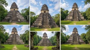
Located on a prominent bluff overlooking the Mopan River, Xunantunich, meaning “Stone Lady” in the Mopan Maya language, is home to the iconic El Castillo pyramid, which rises to a remarkable height of 43 metres. Visitors must first cross the river using a hand-cranked ferry before ascending through the jungle to reach the site. Once there, they can marvel at an astronomical frieze that illustrates the cycles of the sun god and Venus. Local legend tells of a spectral figure, often described as a white-robed spirit, seen atop the central plaza, adding an air of mystery to this enchanting site (Chase & Chase 2015).
Caracol: The “Snail” – Uncover the Largest Maya Site in Belize
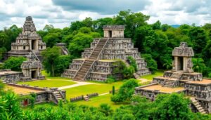
Covering over 200 square kilometres, Caracol reached its zenith around 650 CE, boasting an impressive population of approximately 120,000 residents, establishing itself as a formidable rival to Tikal in terms of power and scale. The site’s Caana (“Sky Place”) temple reaches a remarkable height of 43 metres, making it the tallest man-made structure in Belize. Throughout the site, over 120 carved stelae chronicle dynastic victories, including the notable conquest of Caracol over Tikal in 562 CE, while inscriptions provide invaluable insights into the political history of the Maya civilisation (Chase & Chase 1996). Moreover, advanced agricultural techniques and hydraulic systems reflect the sophisticated urban planning that characterised Caracol.
Cahal Pech: The “Place of Ticks” – A Royal Acropolis Complex
Cahal Pech, translating to “place of ticks” in Yucatec Maya, is located atop a ridge overlooking San Ignacio. As one of the earliest civic-ceremonial centres in Belize, dating back to around 1200 BCE, the site features limestone palaces and ball courts that exemplify early Maya architectural styles. Its convenient location near the town makes it a perfect destination for families and visitors seeking an accessible introduction to the rich history of Maya ruins (Powis et al. 2010).
Venture into Southern Belize – Experience Unique Architectural Styles of the Maya
Lubaantun: The “Place of Fallen Stones” – Renowned for Its Mortarless Construction
Nestled within the misty hills of the Toledo District, Lubaantun is distinctive for its unique black slate masonry, constructed without mortar using ingenious “in-and-out” techniques, resulting in a striking stepped appearance. The site features three ball courts and numerous burial caches that hint at its significant ritual importance. Furthermore, it is here that the infamous crystal skull reportedly surfaced in 1924, although scholars continue to debate its authenticity and origins (Mitchell-Hedges 1998).
Nim Li Punit: The “Big Hat” – Home to the Tallest Stela in Belize
Also located in the Toledo region, Nim Li Punit features 26 intricately carved stelae, the most notable being Belize’s tallest monument, depicting a king adorned with a towering “big hat.” The stelae plaza is believed to have functioned as an astronomical observatory, marking significant equinox alignments, thus showcasing the Maya's advanced understanding of astronomy (Helmke & Awe 2016).
Uxbenka: Recent Excavations Uncover Astronomical Alignments
Since 2015, excavations at Uxbenka have revealed temple platforms meticulously aligned with the points of the solstice sunrise, highlighting the remarkable astronomical expertise possessed by the Maya. Situated near the Guatemalan border, this rural site offers pristine exploration opportunities and provides valuable insights into the political dynamics of Classic-period southern Maya societies (Smithsonian Mesoamerican Research).
Practical Tips for Planning Your Unforgettable Maya Ruins Expedition
Transportation & Access:
Accessing most Maya sites necessitates ground transportation. From Belize City, there are daily bus services or private shuttles that transport visitors to San Ignacio and Corozal; from these locations, various tour operators provide 4×4-driven site visits. Notably, reaching Caracol requires a 16 km journey along unpaved roads, which can often become impassable during heavy rains, particularly from June to October. Domestic flights are available connecting Belize City’s Philip S.W. Goldson Airport to San Pedro and Dangriga; however, these flights do not service inland sites.
Entry Fees & Guides:
All NICH-managed reserves impose official entry fees that range from USD 12 to 25. For further details, visit the Belize Tourism Board. Engaging licensed guides can significantly enhance your experience as they provide expert interpretations of hieroglyphs, architectural features, and the ecological context of the sites. It is important to note that research permits are strictly enforced for academic projects.
Best Time to Visit:
The ideal time to explore the sites is during the dry season from November to April, which typically results in sunny days, manageable humidity levels, and optimal conditions for photography. It is advisable to avoid peak holiday periods, such as Christmas to New Year, when local resorts tend to be fully booked. Additionally, the shoulder months of May and October may offer lower rates and moderate rainfall.
What to Bring:
Visitors should prepare with sun protection, including a wide-brimmed hat and reef-safe sunscreen, alongside long-sleeved shirts to fend off insects. Sturdy hiking shoes are essential for navigating the terrain, and it’s wise to pack water, electrolyte snacks, and extra camera batteries. A lightweight rain jacket can also prove invaluable in case of sudden tropical downpours.
Gain Insights into the Maya Civilisation Through Their Extraordinary Ruins
During the Classic Period (250–900 CE), the Maya civilisation achieved remarkable advancements, including the perfection of hieroglyphic writing, which remains the longest pre-Columbian script in the Americas. They also developed the concept of zero within their vigesimal number system. The orientations of temples throughout Belize reveal intricate connections to solar and Venus-cycle observations, which were vital for their ritual calendars. Extensive riverine trade networks facilitated the exchange of jade, obsidian, cacao, and salted fish between coastal and highland polities, forging essential economic interdependencies across Mesoamerica (Helmke & Awe 2016).
Highlighting Conservation and Respect for Cultural Heritage
The Institute of Archaeology (IA-NICH) in Belize implements a strict permit system for both research and tourism activities, overseeing the management of 14 archaeological reserves. To mitigate wear on fragile limestone structures, visitor limits are enforced during midday hours, and entrance fees contribute directly to the preservation efforts of these sites. Local guide programmes ensure that income generated through tourism benefits the Maya communities directly. Additionally, photography restrictions, such as prohibiting flash in mural-rich chambers and preventing climbing on vulnerable structures, are in place to guarantee that these invaluable sites are preserved for future generations.
Discover the Resilience of Contemporary Maya Communities and Their Cultural Continuity
Today, the Maya communities residing in Toledo continue to uphold traditional milpa agroforestry systems that involve rotating crops such as corn, beans, and squash, emulating ancient agricultural practices. Moreover, community-based tourism initiatives along the Toledo Maya Cultural Route offer authentic homestays and traditional cooking experiences, effectively linking heritage preservation with economic empowerment for the local population (Belize Maya Forest Trust).
Extensive Bibliography for Further Reading and Exploration
-
Institute of Archaeology, NICH. “Protected Archaeological Sites.” https://nichbelize.org
-
Royal Ontario Museum. “Altun Ha Excavations.” https://rom.on.ca
-
Pendergast, David. Altun Ha: Jade Head Discovery and Context. Museum of Belize, 1979.
-
Awe, Jaime. Archaeological Research in Corozal and Santa Rita. Northern Arizona University Press, 2005.
-
Chase, Arlen & Diane. Xunantunich and Caracol: Temple Sites of Western Belize. UNLV Reports, 2015.
-
Chase, Arlen & Diane. Caracol Archaeological Project Reports. UNLV Reports, 1996.
-
Powis, Terry et al. “Cahal Pech Excavations and Regional Role.” Journal of Maya Studies 12, no. 2 (2010).
-
Mitchell-Hedges, Anna. Mysteries of the Crystal Skull. London: Explorer’s Press, 1998.
-
Helmke, Christophe & Jaime Awe. “Ancient Maya Territorial Organization and Astronomy.” Mesoamerican Research Journal 22, no. 1 (2016).
-
Smithsonian Institution. “Uxbenka Archaeological Project.” Mesoamerican Research, 2021.
-
Belize Maya Forest Trust. “Community-Based Cultural Route.” https://belizemayaforest.org
The Article Ancient Maya Ruins in Belize: Complete Guide to 9 Archaeological Treasures appeared first on Belize Travel Guide
The Article Ancient Maya Ruins: Your Complete Guide to Belize’s Treasures Was Found On https://limitsofstrategy.com